|
Early Maps
Western Pennsylvania
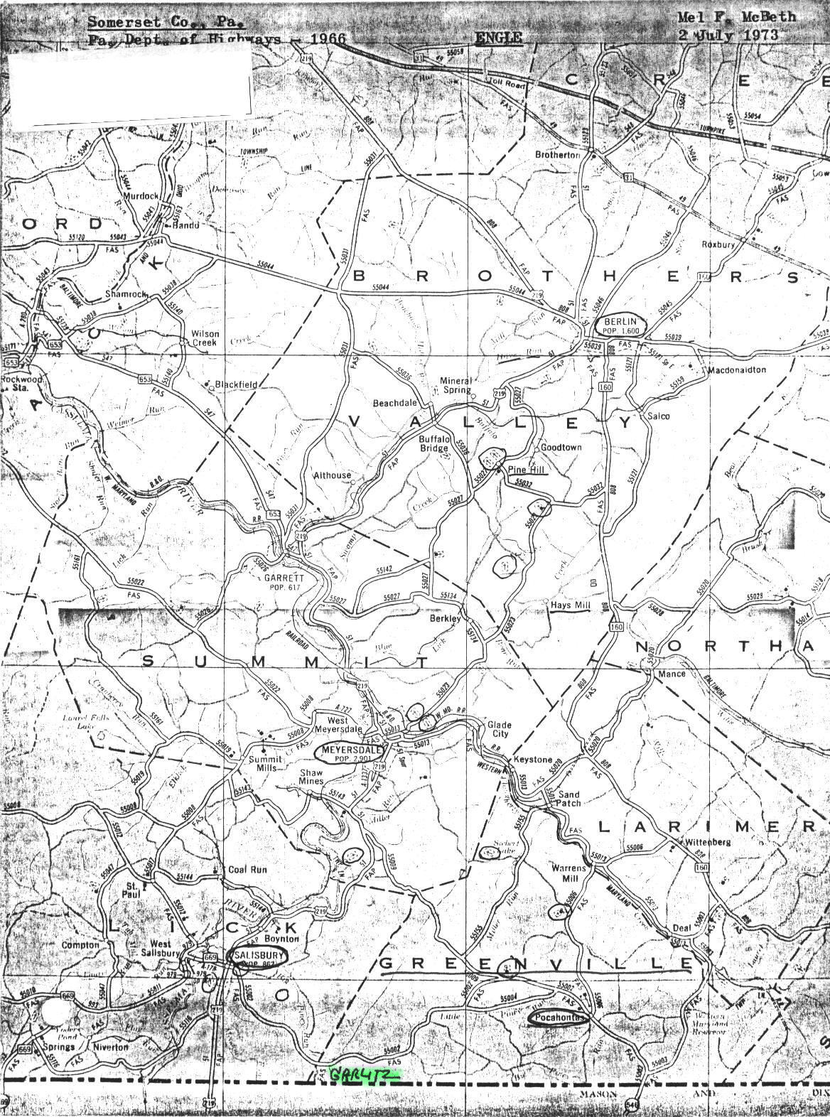
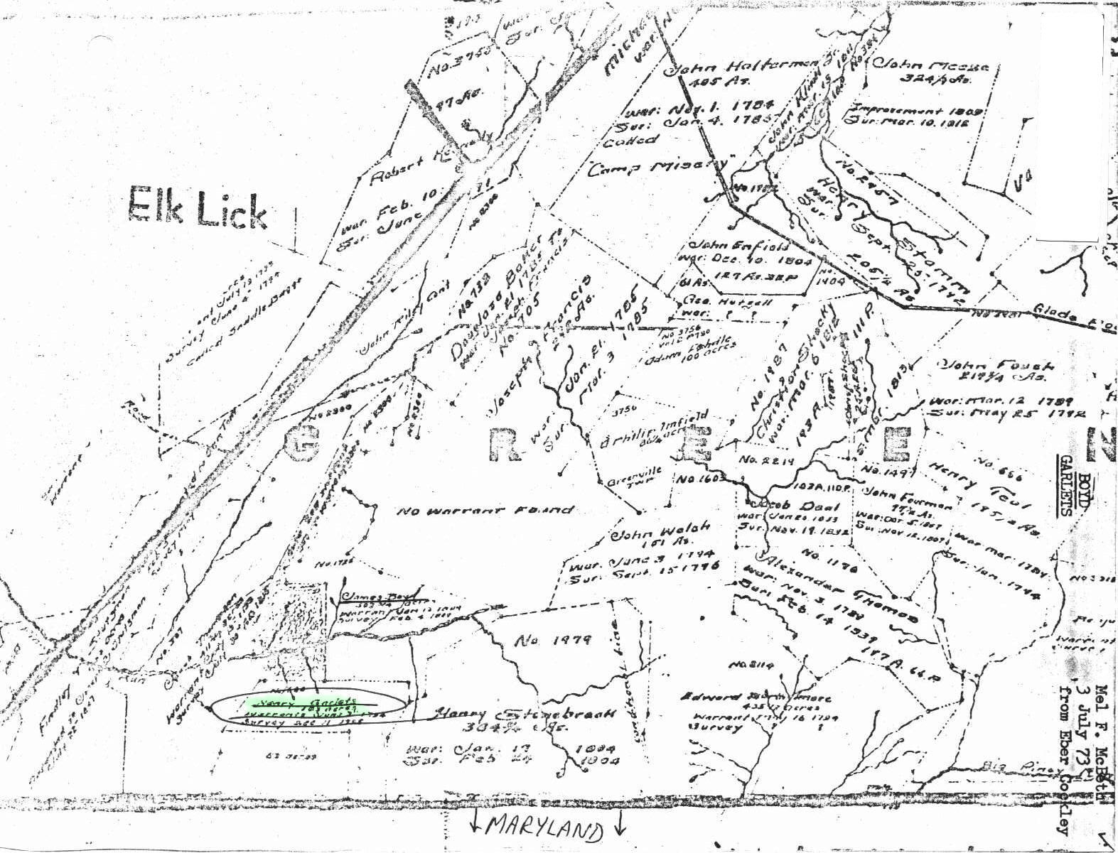
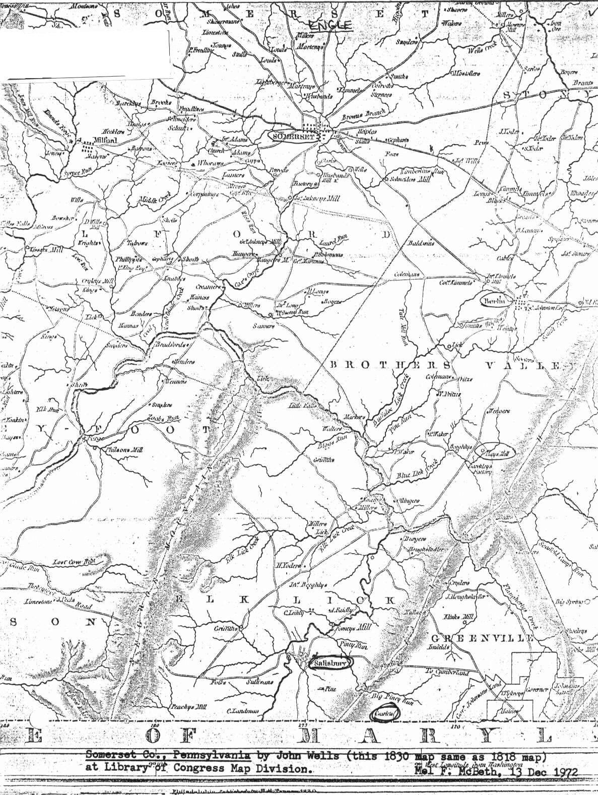
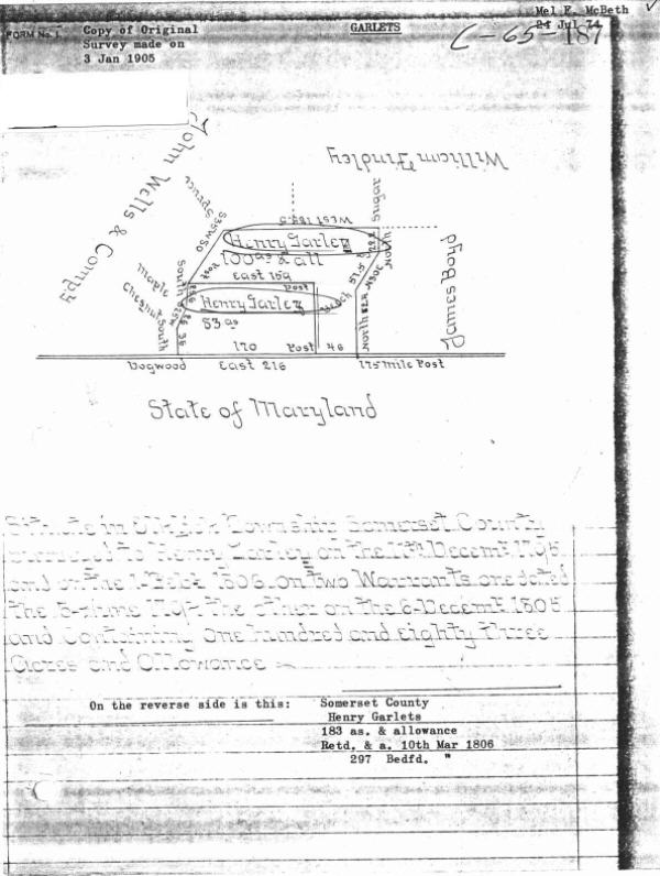
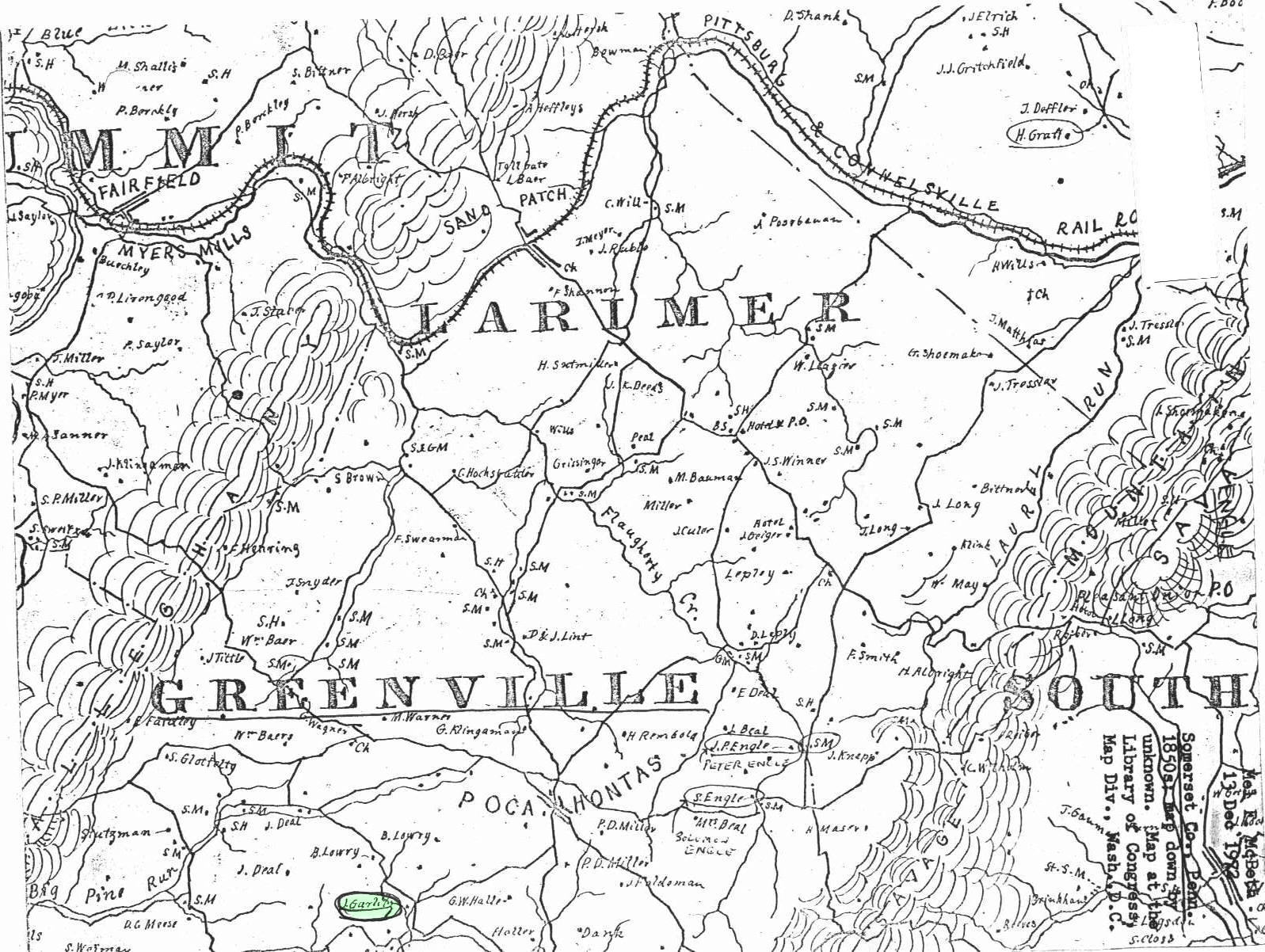
1783 Pennsylvania map showing land purchases from Native Americans. Allegany County Maryland Maps showing the location of the Henry Garlitz farm in Greenville Twp.. Henry, brother to John and Christian and father to Jacob and Christian et. al.. It is possible that this was also the home of Henry's father, also named Henry. Maps submitted by Mel McBeth. (please note: these are large files, necessary for clarity) Henry
Garlitz farm map one
- shows location in relationship to Salisbury & Pocahontas.
Aerial Image of Henry Garlitz property.
The Henry Garlitz farm is now the Herbert
Wright farm (farmed by his son Paul). It is located due
south of Greenville Road. South west of the Salisbury Hunting
Club. West of the Clark Yoder farm. Just north of the
Maryland line. The Maryland state line is clearly visible in the
photo.
|