|
|
|
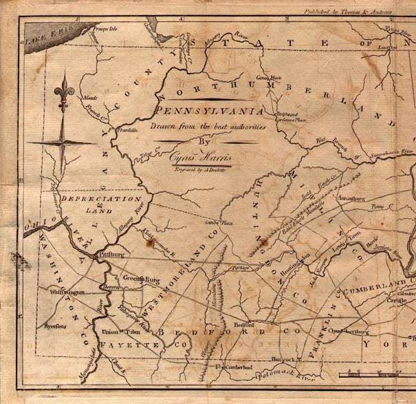
1796 PENNSYLVANIA DRAWN FROM THE BEST AUTHORITIES by Cyrus Harris, engraved by A. Dolittle, published by Thomas & Andrews. This map is from the third edition of The American Universal Geography by Jedidiah Morse, published by Thomas & Andrews, Boston c1796. It can be dated 1789-95 by counties shown. There is no Erie triangle indicating the map was prepared prior to 1792. The 1768 Purchase Line from Canoe Place (Cherry Tree) to the Allegheny River at Kitanning is shown. Delaware is a separate state. There is a compass rose at upper left and longitude is from Philadelphia. No. 446 in Wheat & Brun and listed on page 679 of Phillips. Blank verso. Scale:1"=25 miles. Size: 8.25 x 13.5 inches. |